Home
Galleries
Links
Contacts
About Us
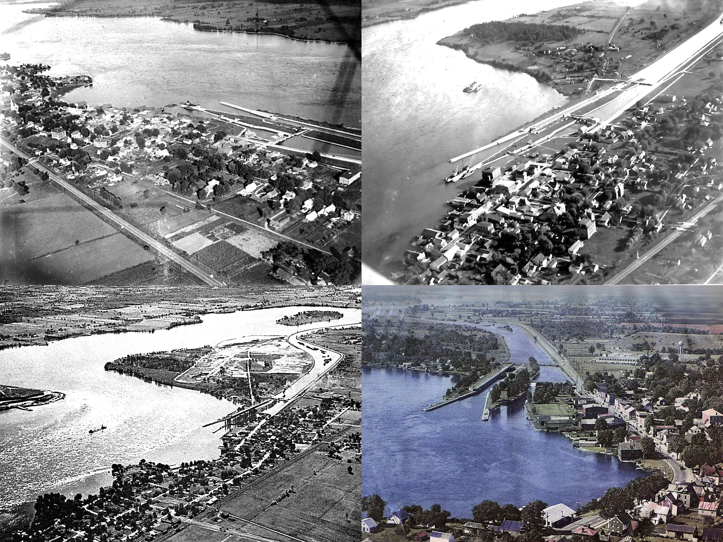
Iroquois, Then & Now
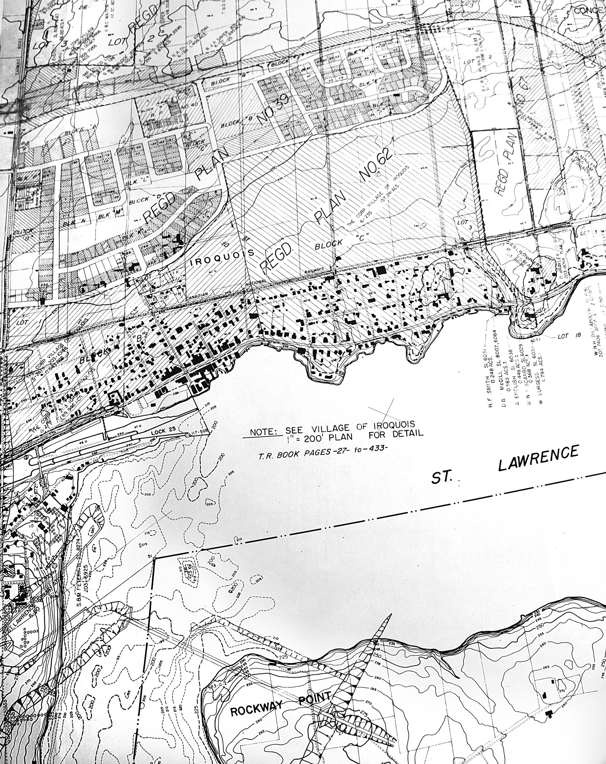
1950s Ontario Hydro Map of Iroquois Before the Seaway.
Click Here
to see the high resolution version of this map.
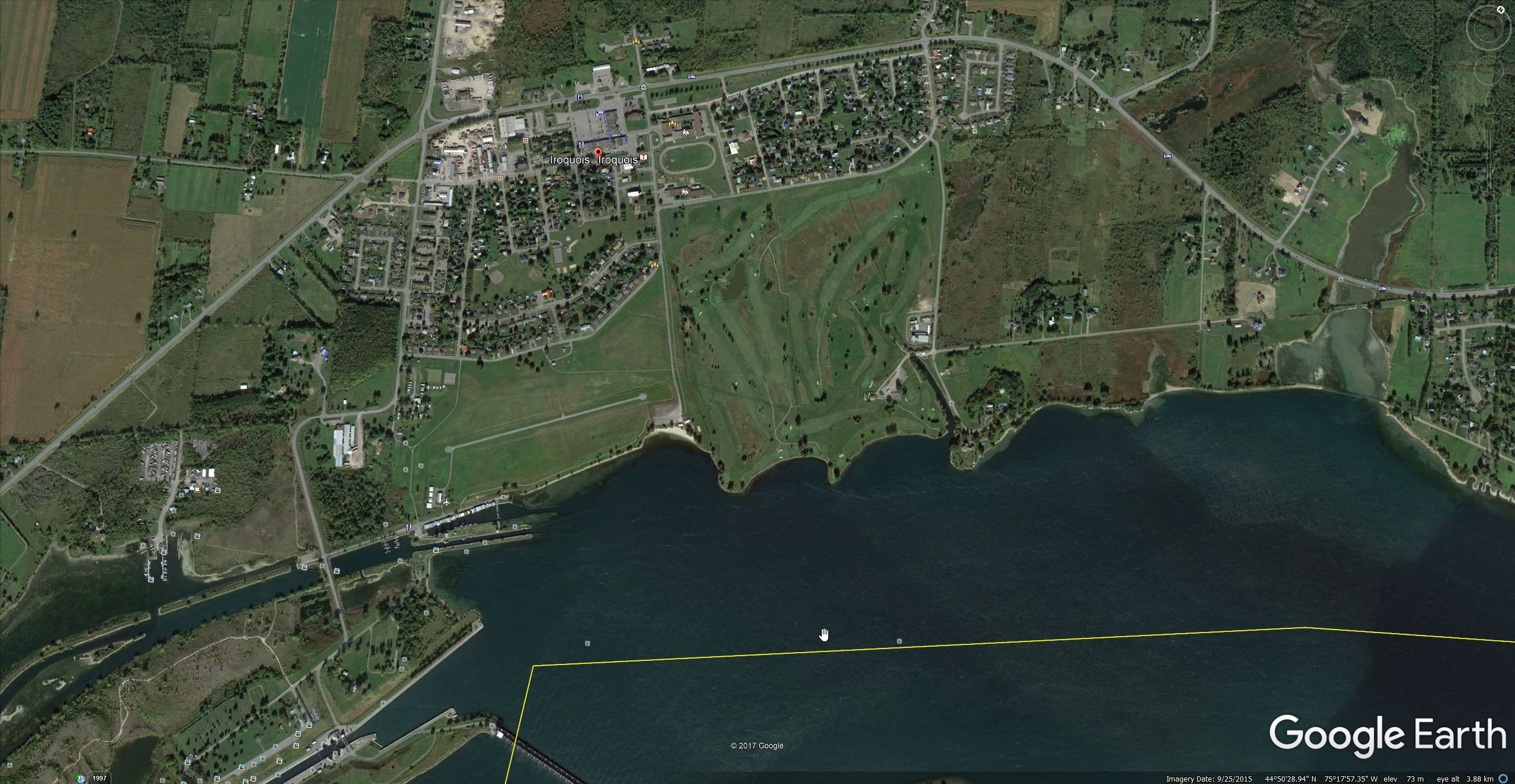
Google Earth Satellite Image From Today.
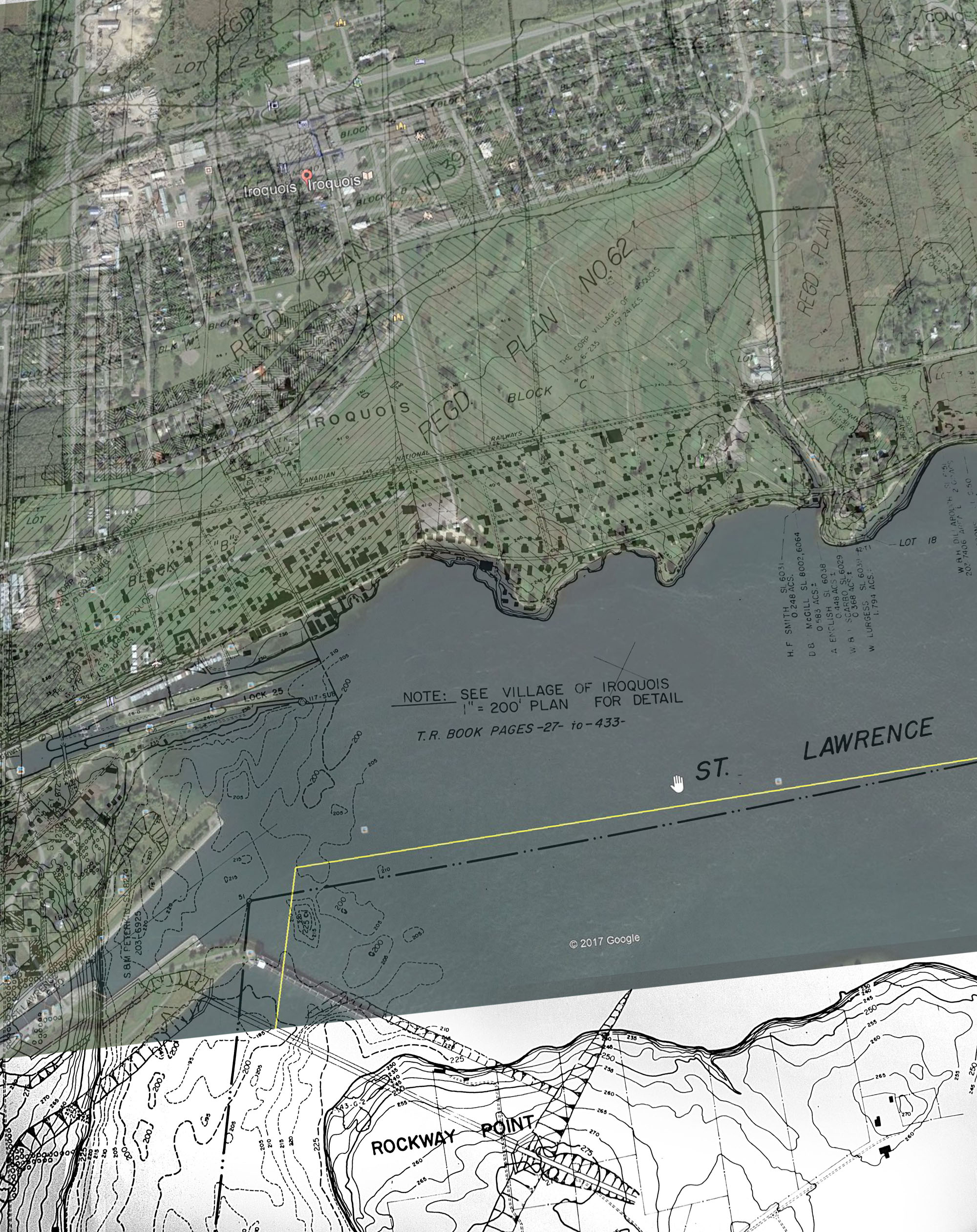
1950s & Today Maps Overlaid Together
1950s Aerial Photograph of Old Iroquois.
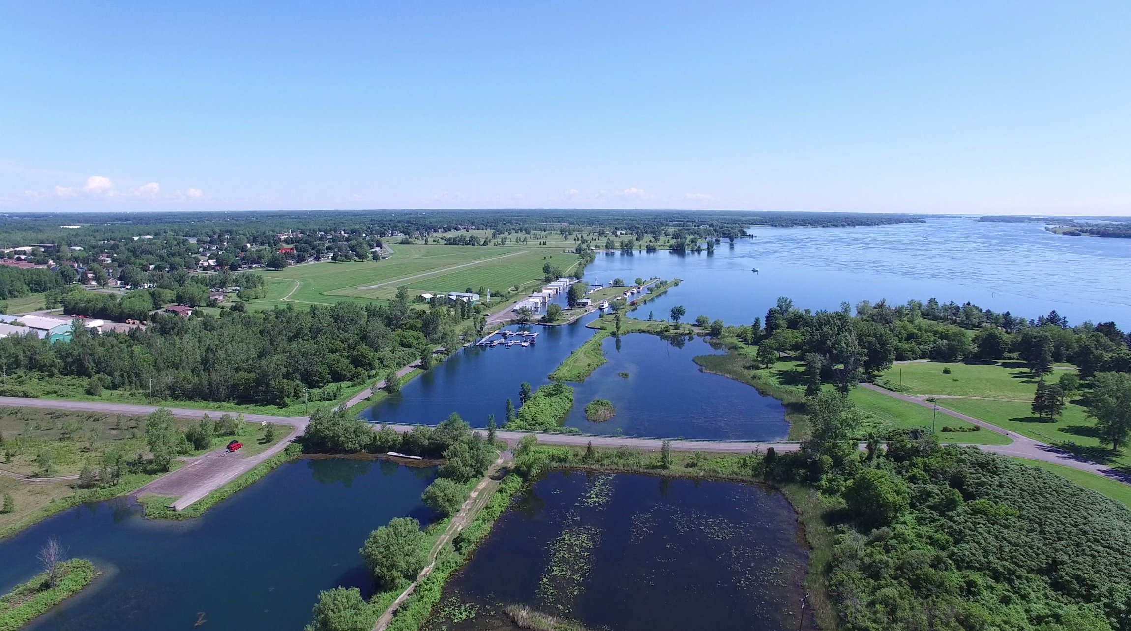
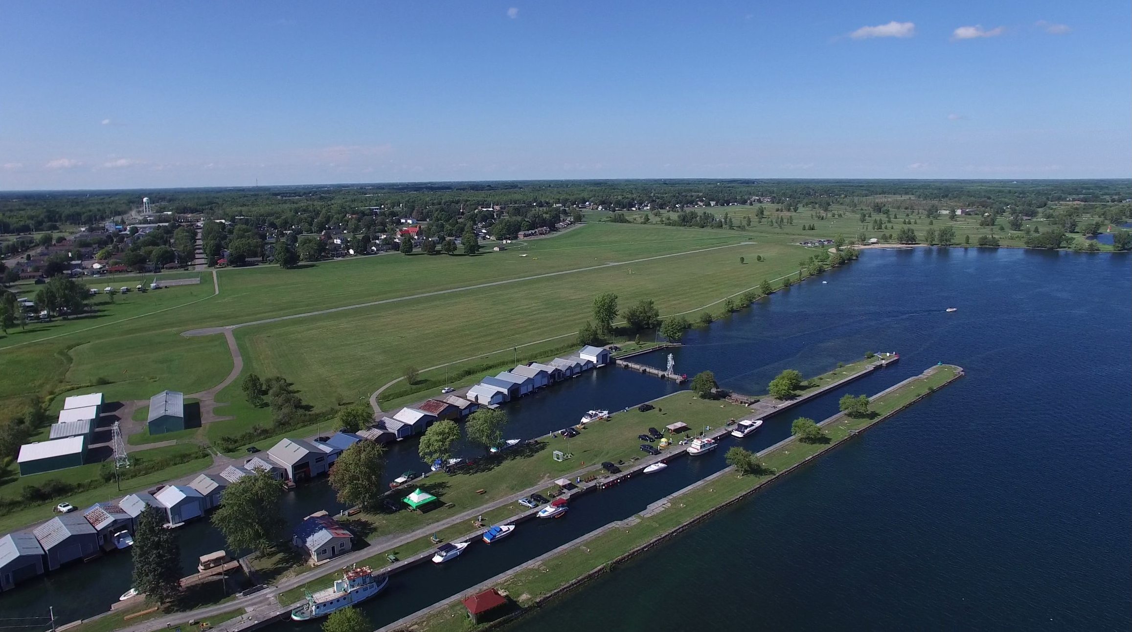
How it Looks Today.